Bastardi Says Snowiest in Over 5 Years NYC to D.C.
Posted 2009-07-14
 By Joe Bastardi
AccuWeather.com
According to AccuWeather.com's Chief Meteorologist and Expert Long Range Forecaster Joe Bastardi, cooler-than-normal
weather this summer in the Northeast could point to a cold, snowy winter for the Northeast and mid-Atlantic states. He says
the heart of winter will be centered over the area from Boston to Washington, D.C.
For people across the Great Lakes and Northeast, this has been the coolest summer in more than a decade.
After a period of more classic summer heat in the coming weeks, cooler weather is expected to continue the trend of the "Year
Without True Summer." For Southeast residents, the hot topic for the end of summer will be the tropics heating up after August
15th.
The Weather So Far this Summer
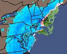
This summer has been unusually cool across the Northeast, northern Plains and parts of the West. Places
like New York City and Philadelphia, which are typically warm and humid this time of year, have had relatively cool and wet
weather instead.
 Click on image for larger image.
While no single factor is taking responsibility for the unusually cool weather, the
combination of El Niño and worldwide volcanic activity over the past six to nine months may have played a role in causing
this trend. The El Niño is a global atmospheric event that takes place over the equatorial tropical Pacific Ocean. The warming
of the waters in that area can result in pattern changes globally, having a major effect on the weather across the United
Sates, especially during the winter months.
People have been commenting on how the "Year Without True Summer" has been affecting them on AccuWeather.com's
Facebook site. The following are a few of the remarks:
- Robin from southern Maine said they aren't swimming or doing much outside, and camping is no fun in the
rain.
- Vince from State College, Pa., pointed out that the Centre County Gypsy Moth website says that a rainy
spring has caused the gypsy moth population to collapse due to an increase in a moth-killing fungus in many areas of the county
In years past, cooler summers have been followed by harsh winters. Temperatures in New York City did not top
85 degrees in June this year. There have only been three other times in recorded history when New York City failed to reach
85 in June. In each of those instances, snowy winters followed.
 Click on image for larger image.
Chicago had 12 days
in June when temperatures did not exceed 70 degrees. This has happened only one other time in 1969. That year was followed
by a snowy winter as well.
Surprisingly, people in Alaska have enjoyed usually warm weather this summer with highs in the 70s and
80s. Fairbanks recorded a record high temperature of 91 degrees on July 8. The unusually warm weather across interior Alaska
has contributed to an increase in wildfires. Almost a million acres have burned due to the persistent hot and dry weather
conditions.
End of Summer Forecast
Bastardi says the current pattern of unusually cool temperatures in the Northeast and Great Lakes will
persist through much of the rest of the summer. However, there will be a five- to ten-day period of more typical summer weather
in these regions by late July and early August before temperatures trend cooler again.
People across the mid-Atlantic, including those in Washington, D.C., Baltimore and Philadelphia, may see
more humid weather through the end of summer despite temperatures being slightly below normal.
 Click on image for larger image.
Across the Southeast, more typical late-summer heat and humidity will prevail. The big area of focus for
people across that region at the end of summer will be activity in the tropics.
According to Bastardi, the tropics will begin to heat up after mid-August. People along the Southeast coast
and across the eastern Gulf of Mexico will especially need to be on guard. Quick-forming tropical storms will be a threat,
leaving people in coastal areas with only a few days notice for preparation.
It is this lack of time to prepare that will be the big danger of this year's tropical season. People from
the coastal Carolinas to Florida, Alabama and Louisiana should be ready well in advance to take immediate action if rapid-developing
tropical storms threaten.
In the Deep South and southern Plains, the hot weather that has gripped Texas, Oklahoma, Arkansas and Louisiana
will remain throughout the rest of the summer. However, the heat should tend to be less extreme.
Along the northern edge of the heat, people across the Rockies, Midwest and Ohio Valley should expect frequent
thunderstorms that could produce heavy rain and flash flooding. These regions have already had their fair share of these heavy
storms so far this summer.
Thunderstorms should also begin to flare-up more across Arizona and New Mexico. Dry weather will be more
the rule rather than the exception for the West Coast from Washington to Southern California. A higher wildfire risk could
result.
A Look to the Winter
Bastardi predicts the current El Niño will fade over the winter and will probably not play as much of a
role in the overall weather pattern as one would think during a typical El Niño year.
The areas that will be hit hardest this winter by cold, snowy weather will be from New England through
the Appalachians and mid-Atlantic, including North Carolina. Areas from New York City to Raleigh have gotten by the past two
years with very little snowfall. This year these areas could end up with above-normal snowfall.
 Click on image for larger image.
While some parts
of the Appalachians did have harsh winter weather in the form of ice last year, this winter could be one of the snowiest since
2002-03, when up to 80 inches fell in many places. Snowfall totals this year could reach between 50 and 100 inches. Last winter,
the usage of salt was way up due to the number of ice storms. Salt supplies could be compromised again this year for state
and local road crews that battle the winter weather. On the other hand, ski resorts could have a great year with plenty of
powder for skiers.
Bastardi adds that the overall weather pattern that has prevailed this summer is pointing to a winter very
similar to that of 2002-03, when major cities on the East Coast had above-average snowfall. Expert Senior Meteorologist Henry
Margusity points out that in February of 2003, a major snowstorm paralyzed much of the Interstate 95 corridor, including New
York City and Philadelphia. During the storm, airports were closed, roads were impassable, roofs collapsed and some schools
were closed for a week, causing summer vacations to start late.
The storm track that could develop this year will bring storms up the Eastern Seaboard. This type of storm
track will differ from that of the past two years, when storms tended to take a track farther west from Texas into the Great
Lakes. That track into the Great Lakes brought unseasonably mild weather to the major East Coast cities, keeping them on the
more rainy side of the storms. The track this year right along the Eastern Seaboard would put the major cities on the cold,
wintry side of the storms.
A colder, snowier winter would mean an increase in energy bills, added snow removal efforts, more travel
delays and extended school closures.
The Midwest and central Plains, which have been hit hard the past two winters,
may end up with a lack of snowfall this year. Places like Chicago, Omaha, Minneapolis and Kansas City may have below-normal
snowfall and could even average a bit milder than past years.
A warm and somewhat dry weather pattern is expected from the Pacific Northwest into the northern Plains.
The typical barrage of winter storms that hit Seattle and Portland may not occur this winter and lead to below-normal precipitation.
The below-normal precipitation predicted for the Pacific Northwest could have "extended and severe ramifications"
on the economy in a region that relies heavily on winter precipitation, according to Expert Senior Meteorologist Ken Reeves.
"A less stormy track through the Pacific Northwest, while on the surface may seem like a good thing, it
is actually the opposite," Reeves said. "Winter snows supply water to the region throughout the year and also supply a significant
portion of their power needs. About 70 percent of electric power generation in the Northwest comes from hydro sources."
The Olympics in Vancouver, British Columbia, from Feb. 12 to 28 could be impacted by the lack of snow and
cold weather this winter.
A storm track into California and the Southwest means near-normal rainfall for Southern California. While
some people across Southern California fear the El Niño will bring harsh storms to the region, the fading of the El Niño will
lessen that risk and provide near-normal rainfall.