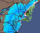
The Storm of the Century, also known as the ’93
Superstorm or the (Great) Blizzard of 1993, was a large cyclonic storm that occurred on March 12–March 15, 1993, on
the East Coast of North America. It is unique both because of its intensity as well as its massive size and wide-reaching
effect. At its height the storm stretched from Canada to Central America, but its main impact was on the Eastern United States
and Cuba. Areas as far south as central Alabama and Georgia received 4 to 6 inches of snow and areas as far as Birmingham,
Alabama, received up to 12 inches with isolated reports of 16 inches, even up to 2 inches was reported on the Florida Panhandle,
accompanied by hurricane-force wind gusts and record low barometric pressures. Farther south from Florida down to Cuba, hurricane-force
winds produced extreme storm surges in the Gulf of Mexico, which along with scattered tornadoes killed dozens of people.

Formation
A "disorganized area of low pressure" that formed in the Gulf of Mexico
(the Gulf is warm by March, and thus is a frequent source of spring snowstorms) joined an arctic high pressure system in the
Midwestern Great Plains, brought into the mid-latitudes by an unusually steep southward jet stream. These factors combined
to produce unusually cold temperatures across the eastern half of the United States.

Forecasting
The 1993 Storm of the Century marked a milestone in
U.S. weather forecasting. By March 8 (and by some accounts even earlier), several operational numerical weather prediction
models and medium-range forecasters at the US National Weather Service recognized the threat of a significant snowstorm on
March 13-14. This was the first time that National Weather Service employees were able to so precisely predict the severity
of an oncoming storm five days in advance, and issue blizzard warnings two days in advance. Because of newer computer and
forecasting techology, forecasters were confident enough to allow several northeastern U.S. States to delcare a State of Emergency
before the snow even started to fall.
Temperatures a few days before the storm were more typical
across the Southeast for early March, and though large fluctuations in temperature are normal in the deep south, this caused
some less attentive residents to doubt that freezing temperatures would return rapidly and that snow was right around the
corner. Certainly the fact that it doesn't snow very often or very much in the deep south added to the disbelief. In addition,
many TV news stations were reluctant to forecast too much snow to the deep-southern public, until it was definite, due to
the unbelievability of the sheer numbers being predicted by the computer models (which were right) and an uncertain public
reaction.
The storm
As Friday moved into full swing, temperatures over much of the eastern United States began to fall quickly. The area of
low pressure rapidly intensified during the day on Friday and moved into northwest Florida by early Saturday morning. As this
happened snow began to spread over the eastern United States, and a large sqall line moved from over the Gulf of Mexico into
Florida and Cuba. The low tracked up the east coast during the day on Saturday and into Canada by early Monday morning.

The blizzard
Temperatures accompanying the storm were unseasonably
cold for early spring: average daily maximum temperatures, in mid-March, are around 46°F (8°C) in Boston, 51°F (11°C) in Philadelphia,
Pennsylvania, and 65°F (18°C) in Atlanta. During the 1993 storm, these places were all near or below freezing, and parts of
New England saw daily maximum temperatures as low as 14°F (-10°C). Record low temperatures for March were recorded in much
of the Southern U.S. Farther to the South, numerous supercells developed over the state of Florida, spawning eleven tornadoes
and killing seven people.
This storm complex was massive, affecting at least
26 U.S. states and much of eastern Canada. Bringing cold air along with heavy precipitation and hurricane force winds, it
caused a blizzard over much of the area it affected. The storm brought snow as far south as northern Florida, thundersnow
from Texas to Pennsylvania, and whiteout conditions. Some affected areas saw more than 3.5 feet (1.0 m) of snow, and snowdrifts
were as high as 35 feet (10.0 m). Central and Southern Florida saw no snow, but tornadoes and severe thunderstorms, resultant
from the storm, occurred there and in Cuba. Responsible for 300 deaths and the loss of electric power to over 10 million,
it is purported to have been directly experienced by over 130 million people in the United States, about half the country's
population at that time. Every airport from Halifax, Nova Scotia to Atlanta, Georgia was closed for some time because of the
storm. The volume of the storm's total snowfall was later computed to be 12.91 mi³ (53.96 km³), an amount which would weigh
(depending on the variable density of snow) between 5.4 and 27 billion tonnes.
Barometric pressures recorded during the storm were
also unusually low: readings of 28.35 inHg (960 mb or hPa) were observed in New England. Usually, such low readings are observed
only in hurricanes (generally of Category 2 or 3 intensity on the Saffir-Simpson hurricane scale), which peak at almost the
exact opposite time of year, or in other cyclonic storms far out to sea. It also pushed a storm surge ashore on the Florida
panhandle, drowning a few people taken by surprise at the storm's ferocity. (This incident is featured occasionally on reruns
of Storm Stories.)
As one of the most powerful storms in recent history,
the storm has been described as the "Storm of the Century" by many of the areas affected. The last blizzard to have such an
effect on the Southeast was the Great Blizzard of 1899.
Impact
In the South, where public works facilities (in most
areas) generally have no reason to be prepared for snow removal, the storm is vividly remembered because it resulted in a
complete shutdown of that region for three days. Cities that usually receive little snowfall, such as Chattanooga, Tennessee,
received anywhere from 2 to 4 feet of snow, causing some municipalities to adopt at least an emergency winter-weather plan
for the future where one may not have existed before. The psychological impact in the Southern states, where average high
temperatures in March tend to run into the 60s Fahrenheit (the upper teens Celsius), was magnified by the fact that it struck
a week before spring. A NASCAR event at Atlanta Motor Speedway (the Motorcraft 500) had to be postponed a week due to the
storm; Birmingham recorded a record low of 2 degrees fahrenheit during the storm. Syracuse, New York, which is accustomed
to heavy snowfall, received a record 43 inches from the storm, while snowfall totalled over 12 inches in New York City and
2 feet of snow fell in Hartford, Connecticut.
The weight of record snows collapsed many factory
roofs in the South, and snowdrifts on the windward sides of buildings caused a few decks with substandard anchors to fall
from homes. Though the storm was forecast to strike the snow-prone Appalachian Mountains, hundreds of people were nonetheless
rescued from the Appalachians, many caught completely off-guard on the Appalachian Trail, or visiting cabins and lodges in
remote locales. The heaviest snow recorded was at Newfound Gap, where U.S. 441 crosses the Tennessee and North Carolina border,
with five feet (1.5 m); drifts up to 14 feet (4.3 m) were observed at Mount Mitchell. Snowfall totals of between 2 and 3 feet
were widespread across northwestern North Carolina. Boone, North Carolina — in a high-elevation area accustomed to heavy
snowfalls — was nonetheless caught off guard by 24 hours of below zero Fahrenheit temperatures along with storm winds,
which (according to NCDC storm summaries) gusted as high as 110 miles per hour. Electricity was not restored to many isolated
rural areas for a week or more, with power outages occurring all over the east. Nearly 60,000 lightning strikes were recorded
as the storm swept over the country, for a total of seventy-two hours, and many may remember their local news organizations
touting the term "thundersnow."
Overall, the Blizzard of 1993 caused a total of $6.6
billion of damage.
Across the Northeastern states and eastern Canadian
provinces, the storm put down an average of 15 inches (40 cm) of snow, which, though most certainly heavy, is not legendary
by most local standards, but still somewhat unusual for mid-March, especially for the southernmost parts of the region such
as the Baltimore-Washington area. New England residents tend to point to the Blizzard of 1978 as their "storm of the century,"
due largely to its unrelenting snowfall, which managed to incapacitate the weather-hardened region, while Mid-Atlantic residents
tend to point to the Blizzard of 1996 for similar reasons. Based on widespread effects, barometric pressures, wind speeds
and satellite images, however, there is little doubt that the storm of 1993 was the more remarkable.
NAO status: After dropping to moderate Negative and occsilating to neutral and back down, storm occured at regeme change
to a highly positive state

500 mb pattern was an open wave trough that closed off as storm headed up east coast

Storm Track/Sytrngth and Snowfall:

Antyicyclone (High Pressure) Sytems Track and Strength: Classic Banana High Setup with 1030+ strength
coming out of Canada in the Upper Plains, secondary high 1020+ tracking east across northern New England

850MB Low Track: East of I-95 but due to contiuation to N/NE changeovers to sleet were common

Forecasts and Models: The Superstorm of 93 was a big "WIN" in meteorolgy forecasting... models
indicated 6-7 days out that there would be big time cyclogenesis on the east coast... as we got closer to the event american
superiority in models at the time flexed their muscles...

Within 48 hrs, the AVN main american short range model nailed all other short term models
to the wall...

with so much advanced warning and of great verification vs forecast this was probably
the biggest forecast succes of all time in winter storm forecasting

