Welcome to WinterCast... the success of Berkswintercast over the past 7 years and the constant
call to expand the focus of its services has led to this creation... The old site was orginally created because of the lack
of focus on the Reading/Berks area... And our theme there will be maintained, this is my home and my base of opporation, however
I have heard the calls from people to add more features for other areas... Basically I am hoping that for all the people of
South Central and Southeastern PA as well as our friends in NJ and down into Delaware come to think of this place as home...
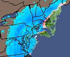
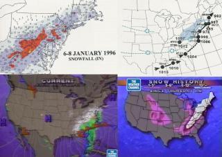
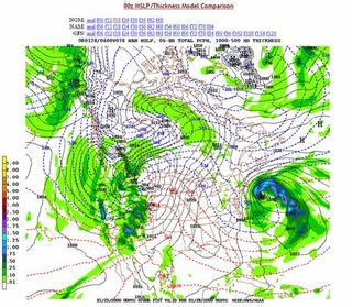
Through out this site you will be able to find all your information you need for the ameture
Met's out there there is lots of model data and for the everyday peroson just curious of weather there are simple 36 hour
and 7 day forecasts for select cities...
In my blog "Jer's Winter Weather Outlook" you will find a daily analysis (some times more)
on the weather both of whats going on currently as well as many looks into the future as well... My own forecast video's will
be added soon too.
________________